Thursday, 31 January 2013

Big Brum Buz Tour!


During Artsfest 2012, my friend and I decided to go on the open top Buz!


It was a lovely, sunny (hot!) day – yes we did have sun last year – and the top deck of the bus was full. We set off from outside the Council House and began our tour! I was sat near the back of the bus so most of the pictures feature backs-of-heads, and any attempt at getting pictures have buildings have resulted in photos of the top storeys only.

We went along Waterloo Street and Newhall Street first – the architecture around here is amazing! I need to spend more time looking up in this City.


A little while later, we passed a building with a pelican on the top of it! The man doing the commentary on the bus said that the pelican was placed here so the delivery boys would know which building to go to – hardly anyone could read, so buildings had different identifying features on them! Very clever.


After passing through the Jewellery Quarter, we headed down towards Edgbaston via Broad Street. 


We went down the Hagley Road and saw J.R.R Tolkiens house!


On the way back into the City, we passed a delightful building just off Camp Hill Middleway – The internet tells me it is called Stratford House (because it is on Stratford Road), and it was built in 1601! You can read a bit more about it here – I hope to go back and get some better photos of it sooner rather than later!


We then came back in Birmingham via Deritend and Digbeth, where we saw even more examples of grand architecture!
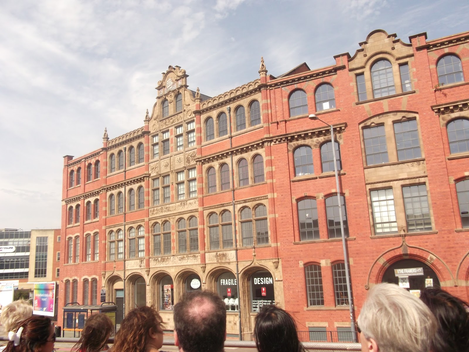


I’d recommend the Big Brum Buz tour if you’re interested in the history of Birmingham – it only took about an hour so it’s not very in-depth information, but it’s enough for you to want to dig and find out more. It’s also a good whip around the city for finding new places to explore, or places to photograph. All in all it was a good way to spend some time, especially with decent weather – but watch out for the low trees!

Sunday, 27 January 2013

Local Explorer Walk - Rea Valley Circular


I walked this route on a lovely, sunny, freezing cold day in December, following a route in the Local Explorer Walks booklet. I started at Fairfax shops, but the route can be started anywhere. The booklet states that the walk is 13km (8 miles) long, but after walking it and tracking it with Endomondo, and then working it out on Google Earth, I can confirm it is a little over 5 miles long, which is 8km. Ish. (Therefore I assume the leaflet has a typo!)

The Fairfax area is a relatively new area of Birmingham – this area was still farmland in the 1940s – and it is mainly low rise flats with some blocks. There is a row of shops, which is where I started the walk. They also sell white Kit Kat chunkys, so it’s worth knowing ;-)

From Fairfax shops, I followed the route North, simply because it was going away from the sun and it would be more pleasant. Follow the road towards the pub, then turn right. This road takes you towards the Fordrough. Head up here towards West Heath Park.


You will then pass through the Fairway – this area is also covered on the previous LEW I did, though this time I missed out Merecroft Pool due to recent weather conditions, and I walked down the road towards Wychall Lane, and then onto King’s Norton Nature Reserve.


If you have been following this blog from the start you will recognise this part of the route. Follow the Rea through King’s Norton Nature Reserve, past Wychall Reservoir and up the back of Staple Lodge Road. You will emerge onto Middlemore Road, near Northfield Railway Station. You now want to follow the route of the railway line – another side note, the chippy on the corner here does a hog roast every Saturday – down Station Road. Go under the railway bridge and then immediately cross the road. There is a small gate on the left – this takes you along a river path called the Mill Walk, which (incidentally) was one of my first posts on the blog! There is a small flight of steps here, or you could carry on up the road to bypass these. Just before the steps is a notice board about the mill that once stood here. Apparently there are remains of the building in all the undergrowth but I’ve never seen it!


This is a 4-way traffic light controlled junction with no proper crossings for pedestrians. Take care crossing here!


This part of the walk is pretty much straight along the river now. Take care when crossing near the ford, and continue walking towards the new estate. This part of the path is now the Daffodil Path, and will take you to Tessall Lane.


Follow the road around to the left and up alongside Longbridge railway station. At the junction turn left, and walk up Longbridge Lane. Keep heading in this direction until you pass a park on the left – you’re nearly at the end!


 Follow the road to the left, and this will lead you to a path, which in turn leads you back to Fairfax shops and the lovely chippy! (What! You need a reward after that walk..)