Monday 3 December 2012

Canal Walk; University to Stirchley

This walk heads south, from the University of Birmingham to Stirchley, along the Worcester and Birmingham Canal. The walk took me about an hour. This route is popular with cyclists and joggers so be prepared to move aside!

I joined the canal via a hole in a wall, near to University railway station (building on the left).


The canal towpath goes over a new bridge that was built as part of the new relief road work. The cross winds up here are quite powerful!!!


At the Selly Oak Railway Bridge, on the left hand side, a graffiti-ed wall can be seen. This is the start of a railway bridge - I'm not sure if it was ever used, but it would have taken the railway in the direction of Harborne.


Towards the end of the walk, you go past the back of the Cadbury factory! Sundays are Dairy Milk days ;-)


This was a really pleasant walk to do on my way home from work on a lazy sunny Sunday! The canal carries on from Stirchley towards King's Norton Junction, but I decided to leave the path here.

Thursday 29 November 2012

Birmingham in the 1300s

At the Birmingham Museum and Art Gallery, there is a new exhibition about Birmingham, called 'Birmingham: its people, its history'. I haven't yet been to it but I've been reading the blogs of a curator there (read parts one, two and three by following the links). Part of this gallery contains a model of Birmingham - the detail in it is amazing - and they have just published a video blog-fly through of the model. It is on youtube here, but I have also embedded it below.

Exploring Medieval Birmingham 1300

After seeing the video, I want to go visit the exhibition even more!

Wednesday 21 November 2012

King Edward VI School, Five Ways


This simple, small plaque can be seen in the pedestrian area of the subway around the Five Ways Island at the top of Broad Street. I happened upon it when walking a new way to an appointment.


King Edwards VI School used to stand on this site – a picture of the grand building can be seen below (from Wiki)


The school is now sited in Bartley Green.

Saturday 17 November 2012

Hawkesley Hall; King’s Norton


One day, I was doing a volunteering shift at Stirchley Stores with a rather nice man called Steve. We were talking about this blog and he asked if I knew anything about Hawkesley Hall. I said, I’ve never heard of it, which was true. Fast forward a few weeks to a day when I decided to go and find it, and I’m quite pleased that I have! There are no remains on the site, so if the signs weren’t here you’d have no idea. There are carved stone blocks with minimal information on, but to someone who doesn’t know, this area just looks like a patch of trees in the middle of an estate.


Hawkesley Hall is possibly the sister manor to Hawkesley House on Turves Green – the former being Little Hawkesley and the latter being Great Hawkesley. There is a chance that the former was the first home of the Hawkeslow family, and then they upgraded and moved to Turves Green. I wish I could claim to be a genius and know all this, but a lot of my information is from here and here.


There is a path around this site, and it supposedly follows the line of the moat. I like this idea; you can walk around the perimeter of the property before taking the path that would lead up to, and now through, the house.


It would be very interesting to know more about this – what the original house would’ve looked like, what the surrounding area would look like, how the Victorian house that was built on the same land would look like etc. I love peering into the past at old buildings and imagining how the world has changed so much in that one location!


Lime Tree Walk


To get to this location, you need to aim for the Hawkesley Estate. I walked up from the canal, but the 45 stops a 5 minute walk away, and the 35 and 27 also stop nearby. Once again, check out my brilliant Google Earth Map to find out more!


Tuesday 13 November 2012

Local Explorer Walk – King’s Norton and West Heath


Based around Merecroft Pool, Wychall Reservoir and West Heath park.

I’ve wanted to find Merecroft Pool for a while, in order to blog about it, but then as I was getting ready to go for a walk, I found a Local Explorer Walks leaflet in my drawer, and I decided to follow the walk that has Merecroft Pool as its focus. I have already covered half of the walk in previous posts – it follows the River Rea route past Wychall Reservoir and behind Wychall Road – so this post may sound familiar if you’ve read the other ones!

I started this route at Merecroft Pool itself, near the entrance to King’s Norton Nature Reserve on Beaks Hill Road. As this route is circular, you can start it anywhere! See my brilliant Google Earth route map for more information.


As I walked this route fairly recently, I can vouch for the need for the walker to be wearing either sturdy waterproof boots, or sturdy wellies! Most of the route around the pool was more mud than not and some of it was a few inches deep. The rest of the route is either along tarmacked walkways or on public roads. It is not really suitable for cyclists, wheelchairs or buggies around the pool, but the rest of the walk is. The route is about 2 miles long.


Merecroft Pool is a former millpond, and this area used to be farmed. It is now built up, suburban Birmingham, and a few houses around the pool have direct access from their gardens to the pool. You can read some more of the history over on the Friends of King’s Norton Nature Reserve website.

I walked this route in an anti-clockwise direction, following the Google Earth map view above. 


The paths are narrow and very muddy! They are not tarmacked and there are lots of low branches.


The route continues over the road and round to the left, back towards Wychall Reservoir. The route here is on a proper road surface.


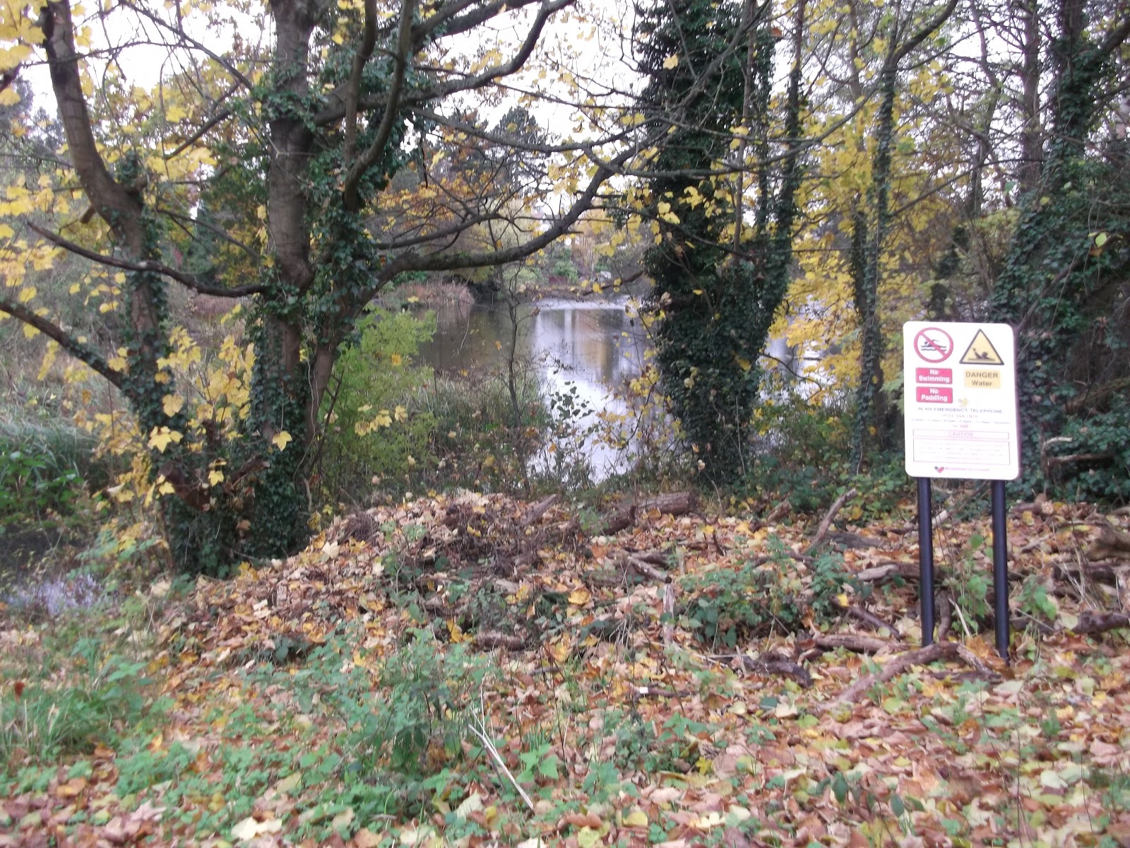
Continue past Wychall Reservoir.


When you leave the River Rea path, you need to head up Staple Lodge Road until you reach West Heath Park. There are paths in the park, though if it has been raining you might prefer to walk up Oddingley Road. Follow the route (it basically follows the line of Oddingley Road) through the park.


 If you do walk through the park, you will come to a set of steps. Follow these, and they will bring you out on Vardon Way.


Continue walking in a straight line, down some alleyways, and you will end up back at the pool!


There are a number of ways of getting here; the 47 goes past and stops near the field on Wychall Lane, as does the 49. King’s Norton railway station is nearby. There is no parking and no visitor facilities. Please take rubbish with you. I didn’t time how long the walk took me, but I walk fairly quickly. The leaflet suggests an hour.

Thursday 1 November 2012

Bournville Village Green


Bournville is a suburb in south Birmingham, about 4 miles from the city centre. The original area of Bournville is centred around a village green with amenities such as places of worship, shops and open parkland for recreation. The original layout remains to this day, and the area is now a designated conservation area.


The village green, surrounding parkland and houses were all planned and built by the Cadbury brothers (George and Richard), who were the sons of John, founder of the Cadbury business. The brothers built the Cadbury factory which is next door to the green.


The Cadbury brothers believed that workers needed a suitable place to live and work, close to the factory, but with large, spacious houses and clean air. The area of Bournville reflects this; houses are semi-detached 3 or 4 bedroom buildings, with large gardens. The land along the river was opened out into parkland, the canal network provided links to the countryside, and at the time, this part of Birmingham was in the countryside anyway, not the modern urban sprawl we are used to. You can read more here, here and here. You can see some pictures here.

Bournville Village Green was the centre of this masterpiece, with a Carillion, a Quakers meeting house,  and local shops including a butchers and a bakers. There are also schools in the area.


I love walking around the Green – it feels very nostalgic and is really quite nice when it’s sunny! All of the buildings retain their original character, and the sounds from the Carillion carry for quite a distance. You can get to the village green area in a number of ways. The 27 and 11 bus services serve this area well, and you can also catch a train to Bournville and then walk up Bournville Lane (follow the signs for Cadbury World). You could also walk or cycle along the Worcester and Birmingham canal, exiting at Mary Vale Road (also the exit for the railway station). You can also drive, though parking during the week is limited.

There is also an information board to tell you more:


Bonus Pics: