Showing posts with label Longbridge. Show all posts

Monday, 11 June 2012

River Rea, Mill Lane

Another local blog post, which nicely follows on from my last post. The River Rea flows through Birmingham, from the Waseley Hills to M6 J6. Yes, the famed Spaghetti Junction! Here, it joins the River Tame and eventually flows into the North Sea.

This post focuses on quite a short section of the Rea in Northfield, from the Lion Bridge to the junction of Quarry Lane and Mill Lane. There are two paths to walk; one is tarmacked and is a continuation of the Daffodil Walk. The other is muddy and very overgrown, but more fun! I walked the ‘cleaner’ path, but diverted to the mud path to get photos. They both start in approximately the same place, and end near each other too. You can either cycle down Mill Lane, or along the path through the woodland.


I didn’t know until a short while ago that there was actually a mill on this river, and I also didn’t know that there are some remains of it left, although they are buried by the plants here. This notice board needs a clean but you may be able to work out some of what it says. The quote in the middle is from a poem called Ode To A Secret River. The notice board is off the tarmacked track - I came upon a fork in the road and turned right. This path was slightly muddier, and has some steps. It is down these steps that the notice board can be found, and the end of the route is in sight.


This is another really nice walk in the ‘burbs. It doesn’t really take you anywhere important, but it makes a change from the standard footpath walk. It is a good place to escape from the bustle of life. It was so peaceful down by the river, I could've stayed there for a while.



There are a lot more photos on the Flickr site, I took quite a few! Some are blurry because I was taking them on my phone as I was walking.

This route is close to public transport links and there is no parking available. It is also near a residential area – please respect this. Also, please remember to take your rubbish with you – there are only one or two bins. This is a wildlife corridor, and there is a river running through it. If you have kids, be mindful of this. Also, the banks can be very slippy after rainfall. When I walked this route, the river was in flood, and although not deep it was going quite fast. The end of this walk is a busy traffic junction with 4-way signals, and no crossing. Please take care crossing here!!

You can get here by train, on the cross-city line to Northfield – this screengrab from Google Earth shows two ways to get here, depending on which platform you alight at.


You can also get the bus. The 27 from Kings Heath/Maypole stops on Abbeydale Road (where the 'Google' is on the pic) near Coleys Lane. Walk down Coleys towards the bridge. Follow the white line under the bridge, the entrance to this walk route is on the left. Take care when crossing here. You can also walk this route as a continuation of the Daffodil Park walk, which is what I did.

L x


Pics were taken by me, June 7th. Feel free to nick 'em. More pics here.

Saturday, 9 June 2012

Daffodil Walk, Tessall Lane


I’ve always called this walk along the river ‘Daffodil Walk’, but it may be more commonly called Daffodil Park. It is situated in Northfield, at the Longbridge end, and the path starts at Tessall Lane down by the Austin Social Club. I can remember playing, walking and generally exploring this park area when I was little with my brother and sister, and then in my teenage years cotching under the bushes to smoke some rather illegal stuff. Anyhoooo…!

This patch of parkland forms part of the National Cycle Route 5 and follows part of the River Rea as it flows north. It is well used by the public, either as a quiet, suburban-country-esque walking route or for other activities. On my walk I saw a few joggers and dog walkers. It is a level route, and has a tarmacked path so it suitable for wheelchair users, and there are grassy areas to allow kids/animals to run around!


Daffodil Park is so called as this flower was grown here in quantities for commercial use.

If you’re looking for a nice, gentle, quiet walking route in Northfield, this could be the one. Despite being a stone’s throw from the railway, Kalamazoo and the Bristol Road, it is so peaceful along this route, and (aside from the building work nearby) the only things you can really here is the babbling brook (the River Rea) and the birds. The route takes you past a newish residential development, and then brings you out by the Lion Bridge! (See how it's all connected? Clever eh?)


There is an information panel part way down the route; it could do with a clean-up. This is what it looked like when I walked the route:


This route is close to public transport links and there is no parking available. It is also behind a residential area – please respect this. Also, please remember to take your rubbish with you – there are a few bins but not many. This is a wildlife corridor, and there is a river running through it. If you have kids, be mindful of this. Also, the banks can be very slippy after rainfall.

To get here, you can take the train on the cross-city route to Longbridge. Take a right out of the station, and turn right again down Tessall Lane. Follow the road, cross the small bridge at the end and the park is opposite. The tarmacked path is further down, and has a totem pole marking it. You can also use the bus: the 63 from Rubery/Birmingham stops up by the job centre on the Bristol Road. Walk down Tessall Lane, Daffodil Park is on the left. The 49 and 45 buses stop by Longbridge railway station.


L x

Bonus Pics:


All pics were taken by me, June 7th. Feel free to nick 'em; they are also on Flickr. Click for bigger!

Friday, 1 June 2012

The Austin Village, Central Avenue


For the second post, I’ve again stayed local. This time, I visited an area that starts at the other end of Turves Green, down by the Woodpecker Pub. From Turves Green, walk up The Oak Walk and take a right onto Hawkesley Crescent. After walking a little way, you will see a road on the left – Central Avenue. Take this turning.


What you see before you is part of the Austin Village, and Birmingham’s first dual carriageway.

These brick houses and wooden pre-fabricated bungalows were built in 1917 for the workers of the Austin factory (Rover). During the Great War, the Austin factory produced munitions and I believe aeroplane parts. In 1997, the area was granted conservation status, and in 2002 two blue plaques were mounted in the middle of the dual carriageway. You can read more about Lord Austin here.


This is a nice part of Northfield to stroll around, especially when the trees are in bloom. Each little bungalow has its own character and the side streets are all named after trees. If you walk down The Mill Walk, you will come to a narrow bridge that carries the railway – this is a two way road! If you walk under the bridge, you will come to a section of the River Rea, a ford, the Lion Bridge and Cycle Route 5. This forms part of a walking route. Generations of kids have played pooh sticks on the Lion Bridge!


There will be a Jubilee street party too, on Sunday June 3rd:


Hog roast!!

You can visit this site in conjunction with Hawkesley House - Central Ave leads all the way up to the moat house area, and is (give or take) a 10 minute walk. 

To get here, take the 47 from Birmingham City Centre/Cotteridge/Stirchley (towards Cofton Hackett) and sit on it for a good 40 minutes. Ask the driver to set you down at the Moby Dick Fish Bar on Turves Green and head for the Woodpecker Pub.

You can also take the train, on the Cross City Line, from Birmingham New Street to Northfield. Leave the station onto Station Road (not via the car park) and take a right, walking towards a traffic light controlled junction. Take a left onto Coleys Lane, turn right at the top onto Turves Green (near some shops). Walk towards the Woodpecker Pub and The Oak Walk. 

This is quiet suburb of Birmingham, and is a residential area as well as a conservation area. Please respect the residents, and remember to take rubbish away with you. There are no public facilites.


All photos in this post were taken by me, today (30th May). Feel free to nick 'em, or visit and take your own! Click for bigger.

Wednesday, 30 May 2012

Hawkesley House, Turves Green


Hello!

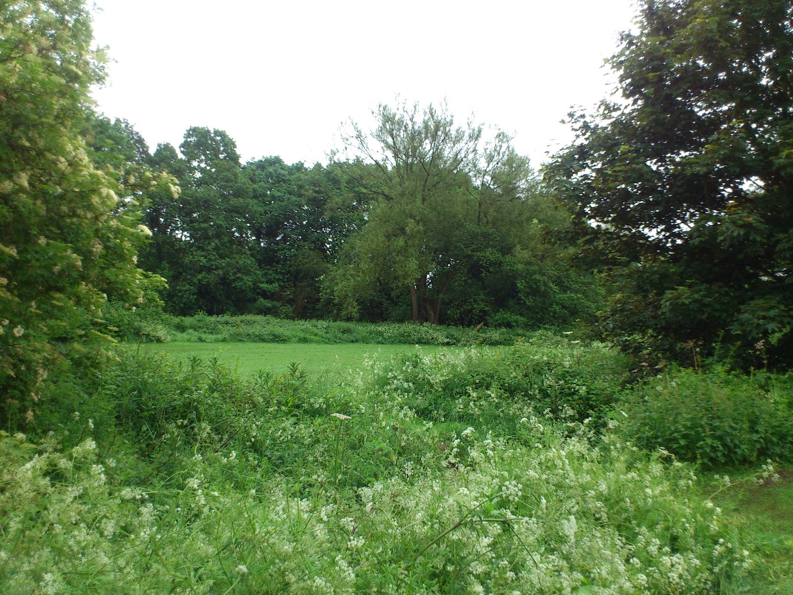
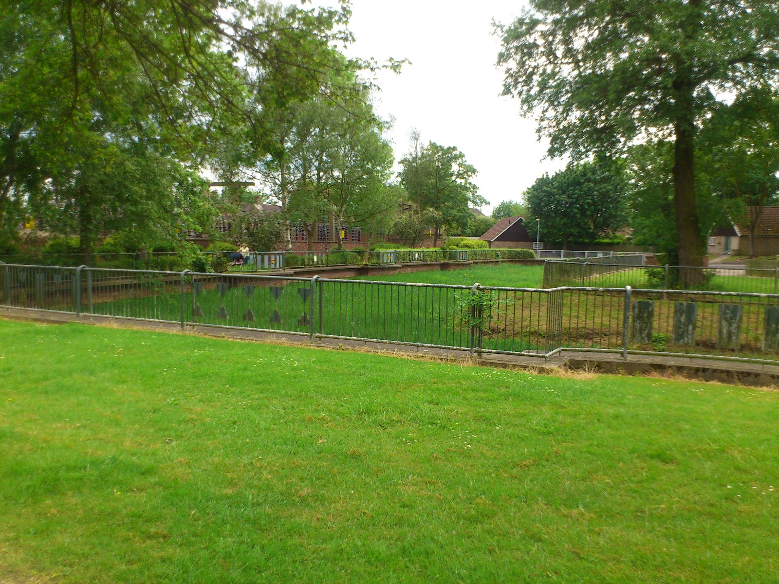
To get things started, beginning the theme and idea of showcasing suburban areas of interest, I ventured out for a 10 minute walk up my local main road, Turves Green. There’s a place up here, hardly anyone knows it’s there, I expect not many more people know what it is (or was). Hidden behind a power substation, down a little cul-de-sac, at the base of a tower block, are the remains of a moat.


This moat once upon a time actually had water in it – the last time I was there (at least 5 years ago) there was some water (and even a token shopping trolley) in it. Today, I was actually really upset to see the state it is in!! The moat has always been overgrown, but now it actually looks so silted, it’s trying to be a meadow or something. It doesn’t surprise me that it has come to be this way – this part of Birmingham isn't exactly on the receiving end of council funding very often and I don’t think there have ever been volunteers or rangers for this site. Anyway, I digress.


The part of the moat that held water has a fence around it, but if you walk between the bungalows and the tower block, on either side of the raised path section, the dips in the ground are actually sections of dry moat which are grassed over. The sides of the dry moats are brilliant for sliding down when we have enough snow! Yes I’m speaking from experience…


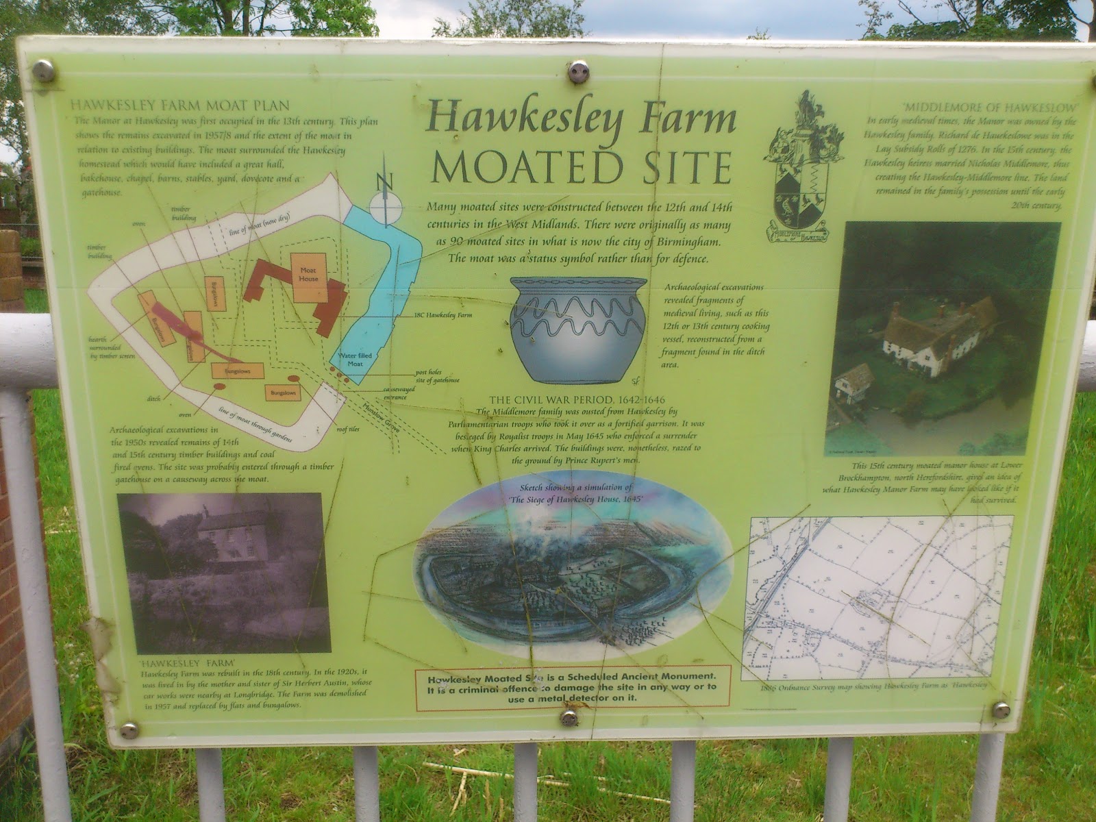
So why is there a moat, hidden away from view in Northfield? Well, there used to be a manor house here! And it turns out that this site is a quite important site of archaeology in Birmingham. Who’d a thunked it. You can download a rather outdated pdf from Birmingham.gov here.

Hawkesley House is a Scheduled Ancient Monument, though there isn’t really much to look at. It was a settlement site from the 11th Century, and the moat added in the 13th. This website has a picture of the moat with water in! This is a very old photo – the flats have had a makeover in recent years and are now white. When I was at school, we came to this site as an afternoon trip, and it’s where I first learnt the basis of geophysics and how it can be used to see subsurface features. People probably don’t associate Northfield with history, or anything remotely manor-house-esque, but here it is, right on many peoples doorsteps! 

If I'm entirely honest, there isn't much to see here, but it's the sense of history you get from walking around the site, especially if you've read up on it. You can begin to imagine where the house was; what this area looked like when it was countryside; what the moat was like when it was all full of water; what life was really like. In a way, it's quite humbling.


So how does one get to this area?

From Birmingham City Centre/Cotteridge/Stirchley – take the 47 towards Cofton Hackett and sit on it for a good 40 minutes. Ask the driver to set you down at Albert Bradbeer School on Turves Green. To get to the moat, you will need to cross onto the side that has the substation, and walk down Munslow Grove.

You can also take the train, on the Cross City Line, from Birmingham New Street to Longbridge. Take a left when you leave the station and walk straight up Longbridge Lane. Turn left at the mini roundabout and walk down to Munslow Grove (~175 yards).

If you are driving, aim for Munslow Grove, B31.

Please be aware – this is a residential area and many of the residents are elderly. Parking is limited and there are no facilities such as toilets here. Also, chavs.

L x

Bonus pics:


All pics in this post were taken by me today, May 30th. Feel free to nick 'em. Click for bigger.