Showing posts with label City. Show all posts

Monday, 27 August 2012

Birmingham Blue Plaque; Lord Nelson


"Trafalgar Bi-Centenary 2005. Admiral Lord Nelson, 1758 - 1805, Whilst visiting Birmingham in August 1802, Vice Admiral Viscount Nelson stayed at Styles' (later the Royal) Hotel, which stood  on the site opposite. Such was the impression that Nelson made during his stay, that after his death at the Battle of Trafalgar, Birmingham was the first place in the kingdom to erect a statue to his memory. This foremost statue still stands in the Bull Ring today. The Birmingham Civic Society"

On the wall of Natwest bank, on Temple Row.

Saturday, 11 August 2012

Bullring Brickwork 02

The second instalment of the bricks of the Bullring! These ones are located just a little way further along, closer to the relocated 47 bus stop.


Tuesday, 7 August 2012

Walking for Heritage; Gun Barrel Proof House

This blog post follows on from the previous Walking for Heritage post.


The second stop on the walking route is the Gun Barrel Proof House, which is located on Banbury Street. From Curzon Street Station follow the route and it will take you right there. Unfortunately you cannot actually enter the grounds of the Proof House – there is some wonderful architecture here and I would love to walk around and get pictures, but alas it is not to be. You can catch a glimpse of the Proof House from the road, behind two sets of gates – this is a working Proof House and I expect they don’t want any accidents! You can also get quite a good view of the Proof House if you are on the train to Lichfield. 


The Birmingham Proof House was established in 1813, at the request of the Birmingham Gun Trade, by an act of Parliament. The job of the workers here is to ensure that guns operate safely, without failure. There is a lot more information freely available on the interwebs about the actual process of proofing. As an aside, the re-enactment unit that I used to be part of had the field cannon proofed here.

You can go on tours around the Proof House – there is an internal museum – but these need to be booked in advance. You can find out more on their website.

You can read more information here and here.

Sunday, 5 August 2012

Bullring Brickwork 01

Not many people know, or notice, the bricks in the Bullring. On August 2nd I stopped to take some photos, and as I was doing so, I noticed a few people stop to look at what I was doing. I asked a few if they had ever noticed before - they said they never had, but they wondered why a young lady was taking photos of bricks. Hopefully more people will notice these now!

There are quite a few clusters of these bricks, so I will blog them separately.

These ones are located on Smallbrook Queensway, near the relocated 63 bus stop.


Friday, 3 August 2012

Walking For Heritage; Curzon Street Station

This post follows on from the first Walking for Heritage post.

The First Stop – Curzon Street Station
From Millenium Point (at the Science Park), walk away from it towards Digbeth. Curzon Street Station is on the left.

Curzon Street Station is a fine piece of stonework, it really is beautiful. A few years ago, before it was boarded up, you could see the old hand pulled signal change levers on the top floor! Curzon Street stands quite proud against a backdrop of investment and change for the City – to one side there is Millenium Point and Thinktank, to the other the start of Digbeth as well as the Bullring. To the front and sides is a lot of building work as the new Eastside Park is being developed. To the back is wasteland – presumably the remains of the old platforms and goods yard, but it is now being used as a storage facility, car park and skate park!


Curzon Street was the original London-Birmingham terminus and opened in 1838. It went through a period of change as it went from being a passenger terminal to a goods terminal, and then it was wholly replaced by New Street Station in 1854. There is a plaque on the front wall near the door that commemorates the anniversary of the first arrival of a train from London.


With the proposed HS2 line due to head this way, Curzon Street could well be once again open for business, as the HS2 London-Birmingham link. I believe the plans are to incorporate the current building into the new one and to also extend the line to Moor Street Station (demolishing Park Street Graveyard on its’ way). I was also told the other day that an industrial estate in Nechalls (down near Dollman Street) would also be demolished, as that is where the tracks are due to be laid.

As a first stop for the Heritage Walk, it is quite a grand start and sets you up wondering what else there is to see in the surrounding area.

Wednesday, 1 August 2012

Walking for Heritage in Digbeth

This will become a series of posts based on a walk that I did recently, which follows a route devised by Thinktank and some young Birmingham citizens. It is called Walking for Heritage and takes the walker around parts of Digbeth that are not usually explored, with a view to showcasing the industrial past of the City. When I walked the route I stopped at extra locations and took photographs; I shall give these their own blog post under the same umbrella heading as it is all interesting! The walk took me about an hour and a half – I kept stopping – and is mostly on footpaths (there is a stretch along the canal, but the towpath is paved) so it is suitable for all users. Digbeth is very much still a hub of activity! Be aware of cars, buses, lorries and forklift trucks.

The route can be viewed here on Google Maps. Leaflets are due to be produced soon, but if you go to the Thinktank blog you can view a .pdf of the route.


The Starting Place – Thinktank at Millenium Point.
Currently obscured by fences due to the construction of the Eastside City Park, Millenium Point is the starting location for this walk. The walk has a route, and is ‘circular’, so you can walk it either way. I started at the start and followed the route, but I expect it’ll be equally as good if done in reverse.

image taken from the Thinktank blog


Friday, 27 July 2012

Curzon Street Canal Tunnel


Another canal tunnel related post, because I found one the other day whilst walking to the Museum Collection Centre. This tunnel is quite short – Google Earth says 0.1miles, but it probably isn’t even that. This tunnel takes the canal under the railway lines that run into New Street Station – the Cross City Line, the Lifford Line and another one that I don’t know the name of.

I accessed the north portal of the tunnel from Curzon Street, near the roundabout by PMT Music. There is a signpost that has been heavily vandalised, and a short stretch of canal, with locks. The tunnel is curved, and has lights!


Wednesday, 25 July 2012

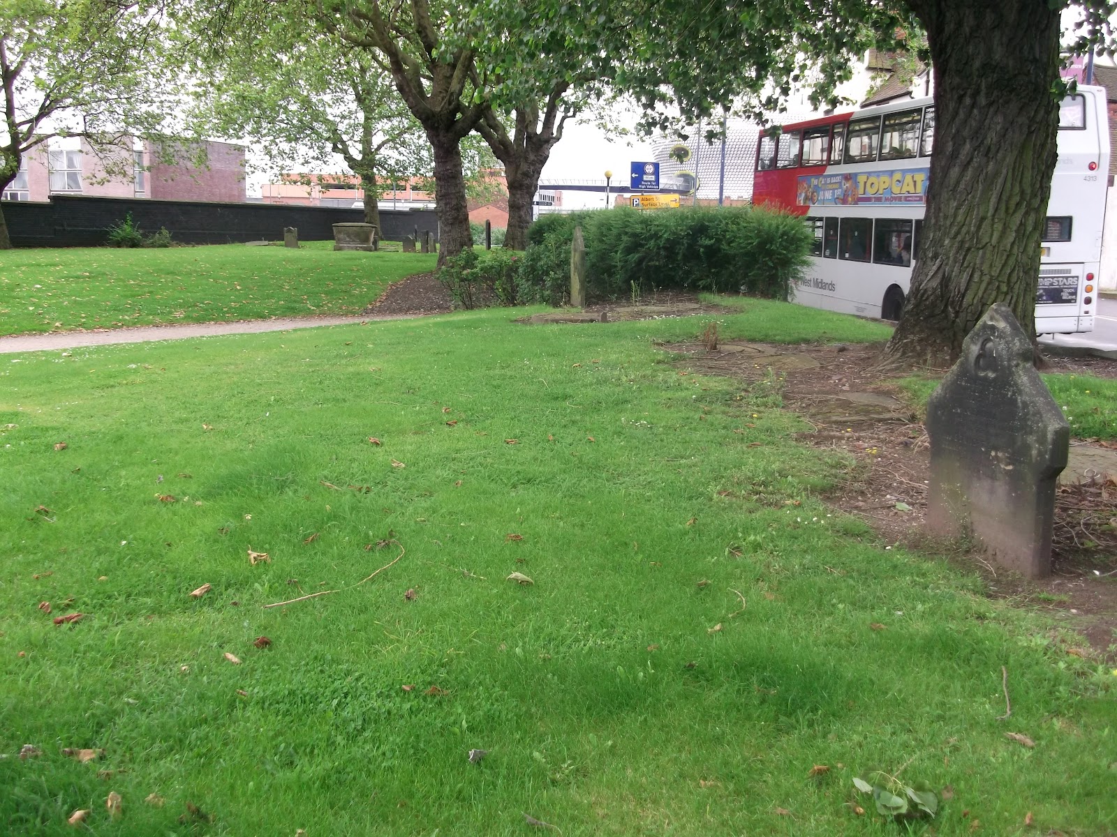
Park Street Graveyard, Birmingham City Centre


Park Street graveyard is a weird little place. 

Behind Moor Street station, next to a busy one way road, near to the railway lines, near Digbeth, near the Eastside development. It is currently just a patch of green in the middle of industrial urban-ness, but there are still some headstones present – some tucked away in the undergrowth, others quite prominent.

When I first came across this a few years ago, I initially thought it was a cholera graveyard, as it is some way out of the main city area. However, some quick internetting told me otherwise – it is actually an overspill graveyard for St Martins (in the Bullring).

I decided to feature this on the blog as it may soon be gone – HS2 will be built over it.


This is very much used as a recreational area, but please respect it for what it is - a resting place. More pics.

Saturday, 23 June 2012

Exploring Birmingham's Heritage - Guest Post


A guest post! Possibly the first of many :-)

This has been written by Rhys Jones, and contains his photos. Links to his websites are available at the end. I was quite keen to showcase this particular stretch of the canals – many Saturdays of my mid-teenage years were spent down here, jumping across the narrower canal sections; walking to and from Robannas Studios and generally mucking around!

I am open to guest posts – just send me an email and we can discuss it further.


EXPLORING BIRMINGHAM’S HERITAGE


Most people are familiar with the glamorous canal area near Broad Street and Gas Street Basin, but the old industrial area of the Birmingham and Fazeley Canal reveals some interesting aspects of Birmingham history. I joined the canal east of the Snow Hill road bridge and walked up a series of 13 locks to the NIA. Parts of the canal are under bridges and large buildings, giving some challenging light conditions for photography.


Although the distance is only just over a mile, I spent quite a few hours walking slowly and taking photographs. One of the most interesting places was the large dark area under Snow Hill Railway Bridge.


The Birmingham and Fazeley Canal was opened in the year of the French Revolution, 1789. In its day it formed part of the main transport artery between the West Midlands and London and was every bit as congested as the M6 motorway is today. Even when the canal company obtained an exemption from the Navigation Acts (which prohibited use of the canals during hours of darkness or on Sundays), enabling the locks to be worked 24 x 7, the problem remained unsolved.

By Rhys Jones


Thanks, Rhys! I hope to blog more about the canal network of Birmingham over the coming months.

Friday, 15 June 2012

Birmingham's Parks

I read a little while ago that Birmingham has over 500 parks. I didn't believe this.

The other day, continuing my love of playing with different layers on Google Earth, I took these two screengrabs. The first is a zoomed out shot of Brum, with roads. The green outlined things are parks & golf courses, or at least the ones big enough to be seen. The second screengrab is the same view, sans roads, but with labels to help you find your nearest park, in the broadest sense. You may be better off looking at your local area map!


Click for bigger. Screengrabs taken June 8th.

It's actually a surprise seeing this much green space in our City. I knew of quite a few.. West Heath, Kings Heath, Cannon Hill, Cotteridge, Kings Norton parks etc., but I never imagined this many.

Who wants to join me in a mission to visit them all?!

L x

Wednesday, 13 June 2012

Tram Lines in the City

A short post this time, to show a few pictures. These are remains of the old tram lines that ran into the City - they can be found between the back of the Council House and the Birmingham Museum (Gas Hall), on Edmund Street.


You can read more here.

Pics were taken by me, May 30th. Feel free to nick 'em. Click for bigger.

Tuesday, 29 May 2012

Google Earth'd Birmingham

I was messing around with Google Earth a little while ago, and I toggled the 3D Buildings option. The result is this, a truly beautiful new way to view our city! I love it :)

Screengrab from Google Earth 14/3/12

You can click it for a bigger version, though I fully recommend going into GE and messing around with the 3D building function, and the sunlight settings; it's truly magical!

L x